Ekinlik Island
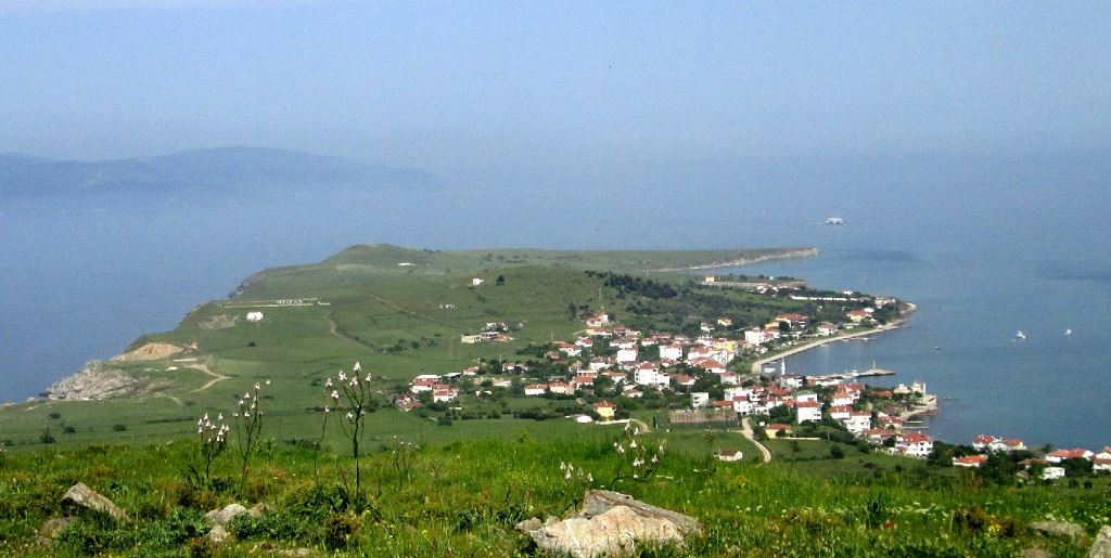
Ekinlik Island is a member of the Marmara Archipelago, which belongs to the province of Balıkesir. It is the smallest inhabited island in the archipelago and is governed by Marmara district. The area of the island is 2.47 km2 and the island has a single village called Ekinlik. The permanent population of the island is 151 people, as per the 2019 census. Unlike Avşa Island, which is right across from Ekinlik Island, it is not a touristic island. Despite this, the island population increases in summer due to the visit of islanders living in big cities.
Where is Ekinlik Island located?
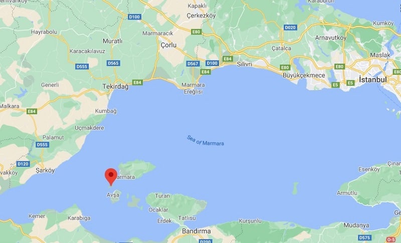
Ekinlik Island is located between Kapıdağı Peninsula and Tekirdağ in the south of Marmara Sea, Turkey. It has a 74 nautical miles distance from Istanbul, 0.6 miles from Avşa Island3.2 miles from Marmara Island.
Where the name of the island comes from?
The name of the island in Greek is Kutali (Koutali). The oldest written source to find this name belongs to the 17th century and was mentioned by the Geographer Meletios of Athens. The origin and meaning of the word koutali is unknown. With the settlement of the Turks on the island, the name of the island changed to Ekinlik. This name was given because the island has a suitable topagraphy for wheat cultivation. An unofficial name of the island is Kaşık Island. This name is mostly used by those living on Marmara Island, because Ekinlik island appears in the form of an inverted spoon when viewed from Marmara Island.
History of the island
Ekinlik Island was not an island until around 10,000 BC, when the last ice age was experienced. As a result of melting ice and rising water, it became an island in 8000 BC. The oldest known traces of settlements in the Marmara Archipelago are dated to the Neolithic age. While there were settlements in the Neolithic, Chalcolithic and Bronze Ages on Avşa Island, we do not yet know if there was also Ekinlik. According to the information obtained from Hittite written sources, it is clear that the region was under the influence of Troy in 1000 BC and that the Luwian peoples lived in the region. The region became a Miletus colony in the 8th century BC, and the first Greek-speaking peoples of the archipelago settled in this period. However, since there is not enough research on Ekinlik Island, we do not have information about the settlements in this period. According to the oldest known records about Ekinlik Island, Catalan mercenaries who came to Byzantium to help invaded the island in the 14th century. After the Byzantine rule, the island came under the rule of the Ottoman Empire from the 15th century. The Greek-speaking Greek population of the island lived on the island in peace and prosperity until the Treaty of Lausanne in 1923. So much so that the population of the island reached up to 2800 at the beginning of the 20th century.
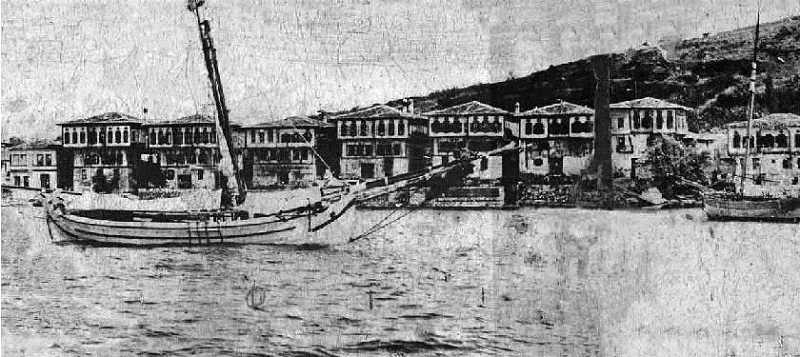
Koutali started to enrich since the 19th century due to the special location of the island. As the fish shoals migrating from the Marmara Sea to the north and south pass by this island, fishing activities have reached the highest level and canned fish facilities have been established. The second important source of income was sponge fishing. There were 22 sponge boats at the end of the 19th century, and each boat could catch about 500 kilograms of sponge a year. But the main wealth of the island people came from sea transportation and ship ownership. Many families who enriched during this period built magnificent wooden mansions by the sea. A few of these houses have survived until today. As a result of the Lausanne Treaty (population exchange) made with Greece in 1923, the Greek-speaking people of the island immigrated to Greece and the United States, and instead, Turkish families immigrating from the coastal towns of Kastamonu city were settled.
Historical remnants in the island
The oldest known history of the island goes back to the Byzantine period, but most of the existing historical remains belong to the past centuries. The oldest structure on the island is the ruins of a monastery dating to the Byzantine period. It is thought that the remains of which you can still notice the apse section are spread over a wide area. At the beginning of the historical ruins that have survived intact, one or two of the mansions dating back to the 19th century come. These wooden masonry mansions, known as the 7 brothers, were built by seven rich captains.
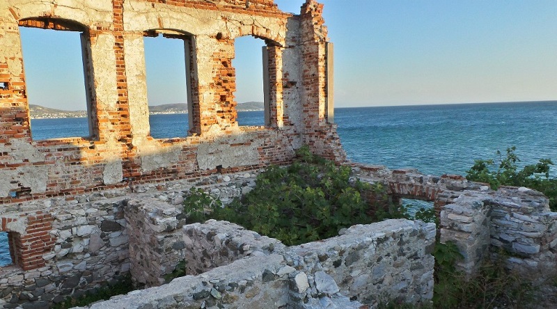
Some of the stone walls of the two-storey school building, which was built in the 19th century, are still standing today. Another remnant whose ruins can be seen are the ruins of a basilical planned church inside the settlement. In addition, there are remains of a chapel and two windmills outside the village. The construction date of 1877 can be read in the inscription of one of the mills.
Accomodation, beaches and facilities
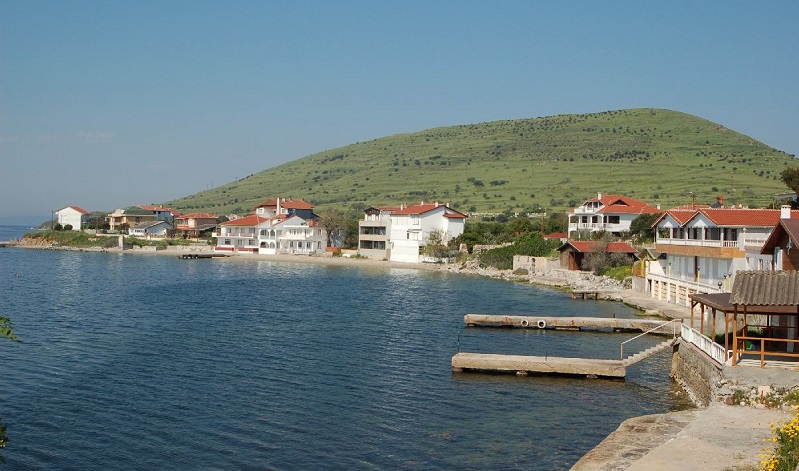
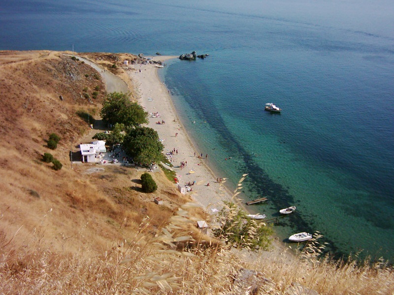
There are no any restaurant and tourist accommodation facilities on Ekinlik Island. But there are three natural beaches with a perfect sea and sand; Cormorant, Kumvoli and Dutvoli beaches.
Transportation and how to get to
Access to the island is provided by boats departing from Avşa Island. You can go to Avşa Island by İDO sea buses, which operate from Istanbul between spring and autumn. The connection of the island with the mainland is provided by the Gestaş car ferry service, which operates on the Erdek-Marmara line and stops on certain days of the week. There are no taxi or public transport facilities on the island. If you do not have a walking obstacle, you will not need a vehicle on the island.
Thanks to the website “ekinlik.org” for leting us to use the photos.